Guidance for using the WRMP Data Catalog
About the WRMP Data Catalog
This data catalog features datasets of relevance to the mission of the SF Estuary Wetlands Regional Monitoring Program. As such, it will include legacy data, created before the advent of the program in 2020, and data produced that are compliant with the program’s standard operating procedures for environmental monitoring.
Currently, this data catalog will not enforce strict data standards to promote consistency among datasets. Data standards remain a near-term goal, but for now, they remain under development. Instead, our approach is to leverage existing data already available in the public domain wherever possible to promote their use, furnishing enough information to you regarding their metadata (information describing each dataset) to advance your understanding of their purpose.
Further information about the WRMP Data Catalog

The menu at the top of the data catalog is an easy way to learn about the data catalog, perform common functions, and understand definitions for the ways of classifying the information describing each dataset (also known as “metadata”).
Searching for datasets
All data within the catalog are available for your use under either broad or narrow terms of use. To reach a page describing each individual dataset, download the dataset, or be redirected to its “home repository,” you may use various techniques. Feel free to use them in sequence as desired:
Searching by text

When you enter text in the search bar and click “Search,” you may identify matches of text across all indexed fields of the metadata. The list of datasets returned reflect those matches.
Searching by clicking a link
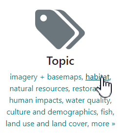
Clicking on a link under the commonly used fields, “Subregion”, “Topic”, “Source”, or “WRMP Indicator” will produce matches based on that term.
Searching by location
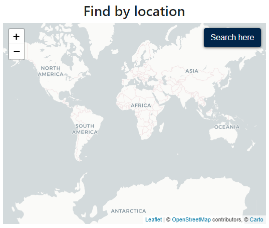
The map provides a way to narrow your returned datasets by the geographic extent of their “footprint.” Narrowing the window by “zooming in” to a smaller geography will reduce the number of datasets shown.
Filtering the list of datasets
When reviewing a list of datasets, you may add filters to narrow the list further until you can more precisely identify a subset of interest to you. Using an analogy, this is similar to online shopping whereby you might select attributes of the item you are seeking until you narrow the list to one that meets your requirements.
Limit your search
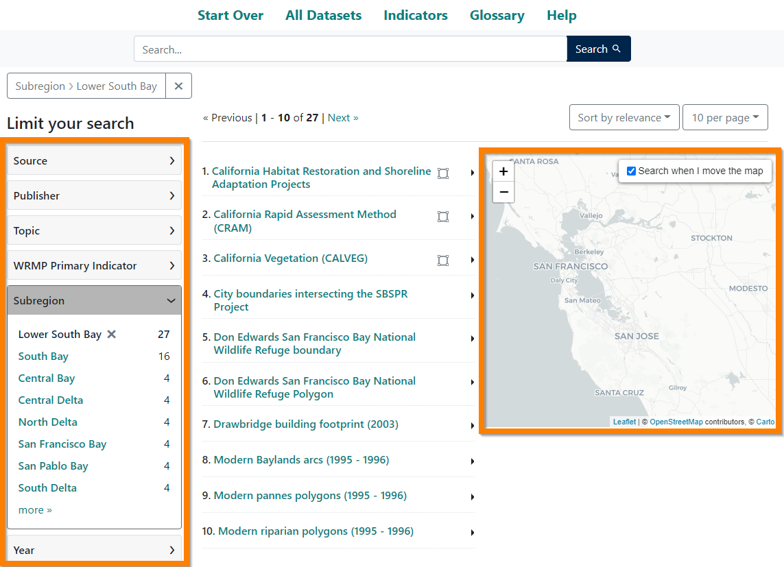
After performing your first search, you will encounter a header called “Limit your search.” This features many of the commonly used attributes associated with metadata. These include “Source,” “Publisher,” “Topic,” and “WRMP Primary Indicator.” To learn more about what these attributes mean, you may consult the “Glossary” listed in the menu.
When you open each facet by clicking on the arrow, the potential values associated with your potentially narrowed list are available. Click on any one of these values to narrow your results further.
Alternatively, since this catalog features data that are all geographic (geospatial) in nature, you may also move the map, zooming in or out, to highlight the geography of your interest. The list will then reflect the filters you have already applied (indicated at the top of the page) and the geographic selection indicated by your map extent.
Attributes in the metadata
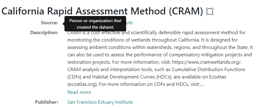
While the “Glossary” defines what each attribute means, you can also review these definitions by hovering over the attributes associated with each individual dataset. This provides easy access to the same definitions.
If you click on a linked value associated with an attribute, then you will, in essence, return a search of all datasets sharing that same value. For instance, if I click on “restoration” as a topic, then all datasets sharing that topic will appear. Then, you may either explore the list or further narrow the list by clicking on values under “Limit your search” or navigate to a specific geography via the mapping interface. (See above under “Limit your search.”)
Accessing data
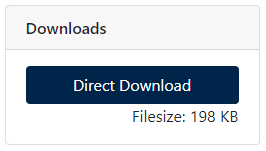
When reviewing a page featuring an individual dataset, you will see either a link to a resource external to the dataset, a link for more information to access the dataset, or a direct link to download the dataset.
For the latter, there will be a file size listed so that you may be prepared to accommodate the downloaded file. Clicking on “Direct Download” will initiate a download.
Please note: The Data Usage Guidelines and License, when furnished in the metadata, might limit the terms by which you may use the dataset or its derived products. Please bear these factors in mind when downloading and using the information featured in each dataset.
A global set of usage guidelines also appears at the bottom of the site for your consideration.
“Unfiltering” your results
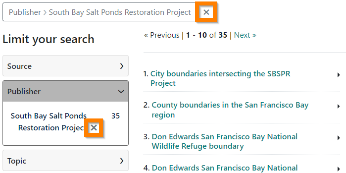
Not every search is successful. If your search results in a “dead end,” you may remove filters that are inessential to you by clicking the “X” next to their names at the top of the page or limiting list on the left-hand side.
Alternatively, you may also click “Start Over” in the menu to return to the home page. Clicking “All Datasets” brings you to a list of all datasets currently available in the data catalog.
This list will continue to grow in time, so please check back again soon to see the latest offerings.